Browse

···
Log in / Register

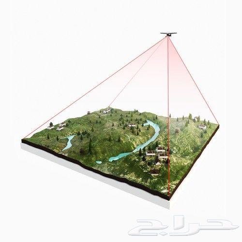
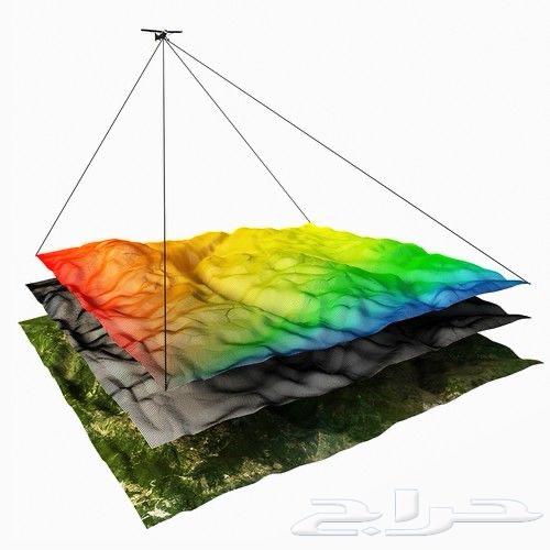

🔹 All available services: 1) Aerial Topographic Survey • Full aerial survey for farms and engineering sites • High-precision ground data collection using RTK / PPK 2) Aerial Mapping • Ultra-high-resolution Orthophoto maps • DSM / DTM elevation models • High-accuracy Contours topographic maps 3) 3D Modeling • Realistic 3D Model of the site • Processed professional-grade Point Cloud extraction • Accurate dimension and volume measurements from the model 4) Engineering Quantity Calculations • Cut & Fill earthwork volume calculations • Ready-to-use quantity reports for contractors and engineering offices 5) Professional Aerial Photography • Photography for farms, subdivisions, and recreational areas • Structural inspections and construction progress documentation • Real estate photography suitable for advertisements and marketing presentations 6) Delivery of Complete Engineering Files • DXF – KML – SHP – TIFF – LAS – CSV • Files ready for use in AutoCAD – ArcGIS – Global Mapper – Pix4D 7) Drone-based Site Inspection Services • Inspection of rooftops, tanks, and pipelines • Monitoring of projects, roads, and farms 🔹 Service Features: • High accuracy using modern technology • Practical field experience in engineering and mining projects • Fast delivery times and ready-to-use results • Coverage across all regions of the Kingdom • Competitive pricing with guaranteed quality ⸻ 📍 Location: Najran – Services available in all cities